10 Little-Known Facts About the Ogallala Aquifer That Supplies 20% of the U.S.
Beneath the Great Plains lies something most Americans never think about, yet depend on every single day. It’s not oil or gold. It’s water. Massive amounts of it, stored underground in a geological marvel that quietly feeds the nation’s heartland. Without it, grocery store shelves would look dramatically different, and whole communities would simply cease to exist.
The Ogallala Aquifer isn’t a lake or river buried beneath the earth. Think of it more like an enormous underground sponge that stretches beneath eight states and holds enough water to profoundly impact everyone who eats food grown in America. Here’s the thing, though: it’s disappearing faster than nature can refill it. Let’s dive in.
It’s Not Actually a Lake Beneath Your Feet
The Ogallala Aquifer is actually like an underground sponge – buried layers of sand and gravel saturated with water. Most people imagine vast caverns filled with clear blue water, but that’s not how aquifers work. The Ogallala is composed primarily of unconsolidated, poorly sorted clay, silt, sand, and gravel with groundwater filling the spaces between grains below the water table. Water exists in the tiny gaps between rock particles, much like how water soaks into a kitchen sponge. The Ogallala was laid down about 10 million years ago by fluvial deposition from streams that flowed eastward from the Rocky Mountains during the Pliocene epoch.
The Aquifer Covers an Area Larger Than Many Countries
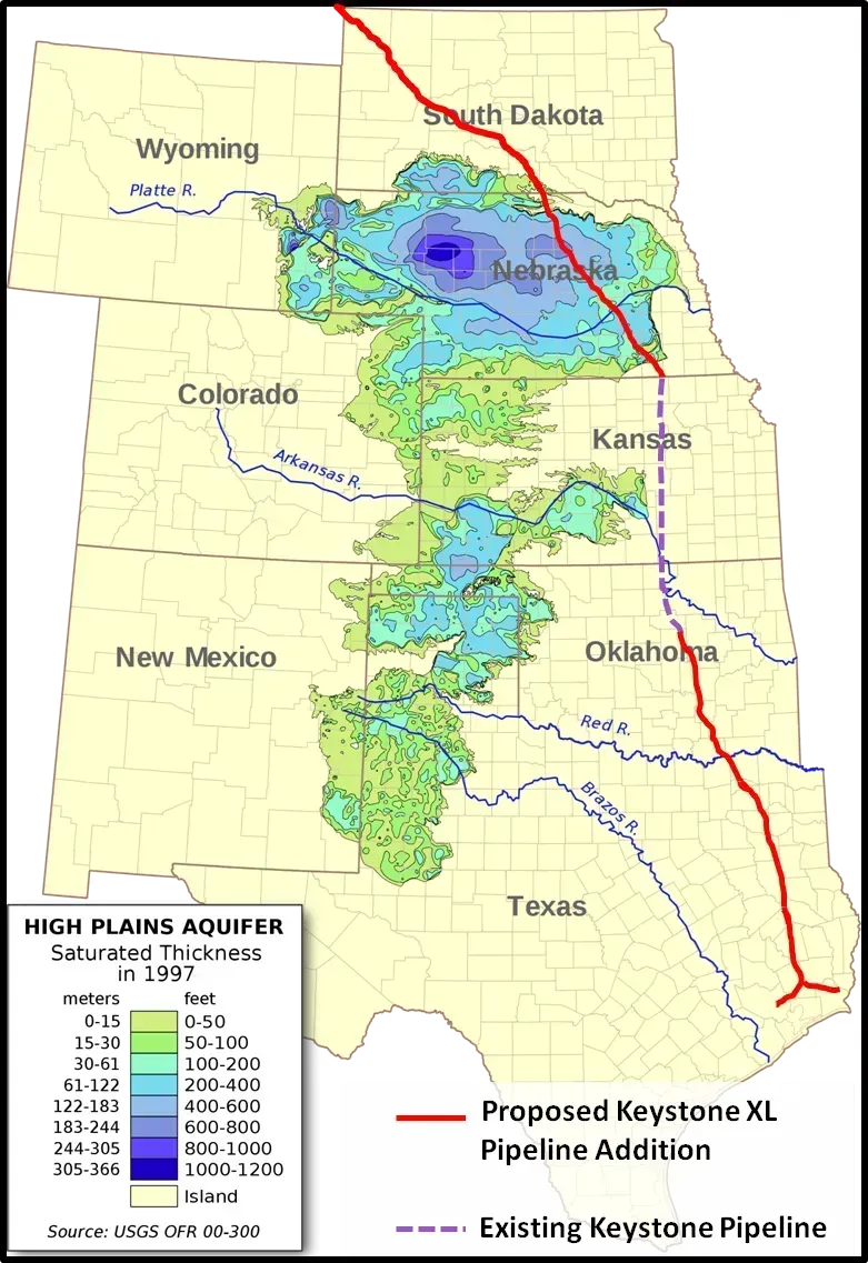
The Ogallala Aquifer underlies an area of approximately 174,000 sq mi (450,000 km2) in portions of eight states (South Dakota, Nebraska, Wyoming, Colorado, Kansas, Oklahoma, New Mexico, and Texas). To put that in perspective, that’s bigger than the entire state of California. The Ogallala aquifer holds enough water to cover all fifty United States in 1.5 ft of water. That’s three billion acre-feet or one quadrillion gallons (a million billion gallons or 1,000,000,000,000,000 gallons), about the volume of Lake Huron. It’s hard to wrap your head around numbers that large, honestly. Yet this colossal reserve is being drained at a shocking pace.
Nearly One Third of America’s Irrigation Water Comes From This Single Source
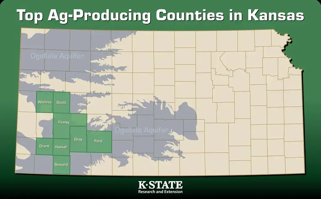
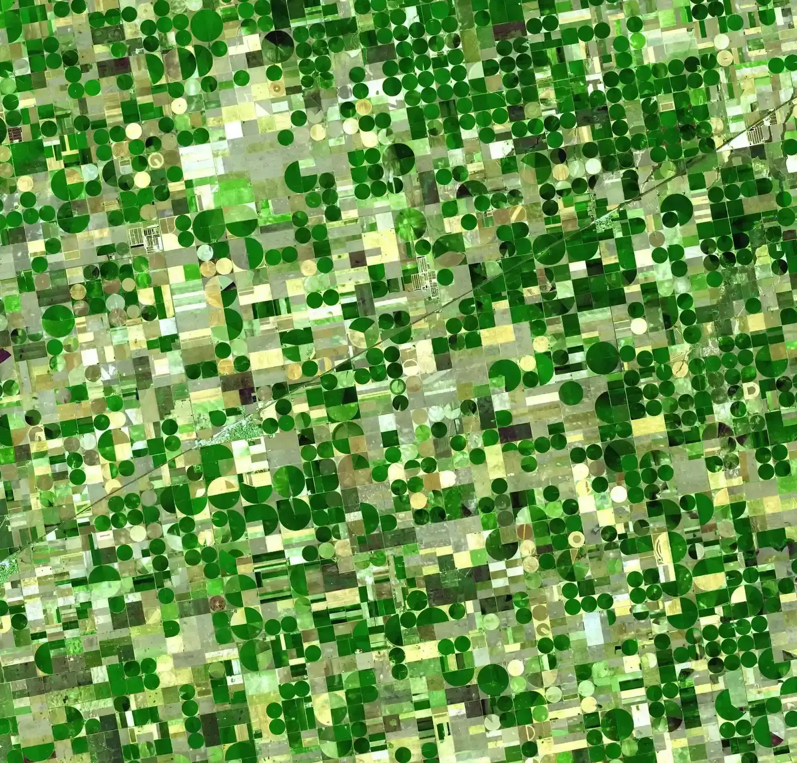
About 27% of the irrigated land in the entire United States lies over the aquifer, which yields about 30% of the ground water used for irrigation in the United States. That’s an astounding concentration of agricultural dependency on one geological feature. The aquifer supports 20% of the nation’s wheat, corn, cotton and cattle production and represents 30% of all water used for irrigation in the United States. Without the Ogallala, the American breadbasket would revert to the arid, difficult-to-farm landscape it was before World War II. “Amber waves of grain” covered the High Plains creating the prosperous grain belt – or breadbasket – that produces about 25% of the crops Americans rely upon for much of our food and animal feed today. Ogallala irrigation water supports $35 billion in crops every year.
The Water Is Ancient – Like Ice Age Ancient
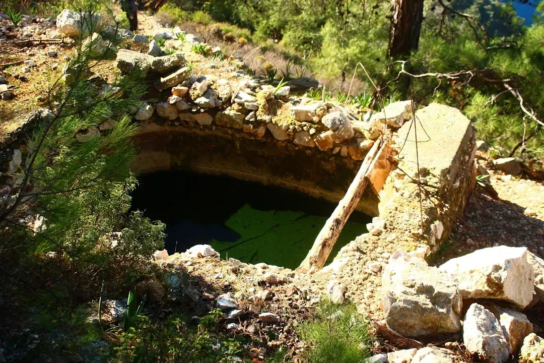
Much of the water in its pore spaces is paleowater, dating back to the most recent ice age and probably earlier. Let’s be real: when you pump water from the Ogallala, you’re extracting moisture that fell as rain or snow tens of thousands of years ago. The Ogallala, it turns out, is what’s called fossil water. It was filled by the melt of continental ice sheets during Pleistocene ice ages. Some hydrologists think that took six million years. This isn’t a resource that nature can quickly replace. Essentially, we’re mining water that accumulated over geological timescales, and using it up within a single human lifetime.
Recharge Rates Are Painfully Slow – Less Than an Inch Per Year
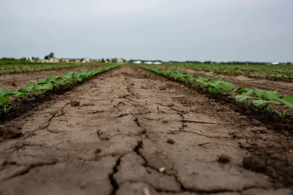
The Ogallala is recharged primarily by rainwater, but only about one inch of precipitation actually reaches the aquifer annually. That’s barely enough to keep up with natural evaporation and plant uptake in this semi-arid region. Recharge in the aquifer ranges from 0.024 inches (0.61 mm) per year in parts of Texas and New Mexico to 6 inches (150 mm) per year in south-central Kansas. The stark reality? Much of the plains region is semiarid, with steady winds that hasten evaporation of surface water and precipitation. In many locations, the aquifer is overlain, in the vadose zone, with a shallow layer of caliche that is practically impermeable; this limits the amount of water able to recharge the aquifer from the land surface. It’s like trying to refill a bathtub with an eyedropper while someone else has the drain wide open.
Water Levels Have Dropped More Than 150 Feet in Some Regions
Recent U.S. Geological Survey data from 2024 revealed that some areas, particularly in western Kansas and the Texas Panhandle, have seen water table declines exceeding 150 feet since the 1950s. That’s taller than a 15-story building. According to preliminary data presented to the Kansas House Water Committee, aquifer levels in the groundwater management area covering southwest Kansas fell by 1.52 feet between January 2024 and this month, a larger drop than the 1.43-foot decline the year before. In some parts of Kansas, some parts of western Kansas don’t have groundwater enough to last another 25 years. Water levels in the stretches of the Ogallala underlying Kansas have dropped an average 28.2 feet farther below the surface, far worse than the eight-state average of 16.8 feet. Water levels in Texas, where the Ogallala runs under the state’s panhandle, have dropped 44 feet.
It Would Take Over 6,000 Years to Naturally Refill
Once depleted, the aquifer will take over 6,000 years to replenish naturally through rainfall. Think about that for a moment. Six millennia. That’s longer than recorded human history. Scientists say it will take natural processes 6,000 years to refill the reservoir. We’re essentially draining a resource in decades that nature took thousands of years to create. Once depleted, the aquifer will take over 6,000 years to replenish naturally through rainfall. I know it sounds crazy, but we’re gambling with a resource that future generations may never see restored in their lifetimes – or their great-great-great-grandchildren’s lifetimes, for that matter.
Texas Could Lose 70% of Its Irrigated Land Within Two Decades
A University of Texas projection in 2025 has indicated up to 70% of the Texas Panhandle will become unusable within 20 years if current pumping rates continue. That’s not some distant, theoretical problem for our grandchildren. That’s happening right now, within the next generation. In West Texas, the High Plains Underground Water Conservation District reported that over 60% of wells surveyed in 2024 had reached levels below the pump intake. When wells hit those depths, they stop working entirely. Farmers face impossible choices: dig deeper and spend more, switch to dryland farming with dramatically reduced yields, or abandon agriculture altogether. This is the breadbasket of America – the region that supplies at least one fifth of the total annual U.S. agricultural harvest. If the aquifer goes dry, more than $20 billion worth of food and fiber will vanish from the world’s markets.
Most Water Is Lost Between 2001 and 2011 Than the Entire 20th Century Combined
Losses to the aquifer between 2001 and 2011 equated to a third of its cumulative depletion during the entire 20th century. Let that sink in. In just one decade, we depleted as much water as we did in the previous hundred years. Since major groundwater pumping began in the late 1940s, overdraft from the High Plains Aquifer has amounted to 332,000,000 acre-feet (410 km3), 85% of the volume of Lake Erie. That acceleration is terrifying when you map it out. A 2023 report highlighted a net loss of approximately 9 million acre-feet across the system since the turn of the millennium. Despite improved irrigation technology and conservation efforts, we’re still extracting water faster than ever before.
States Have Wildly Different Rules – And No Unified Plan
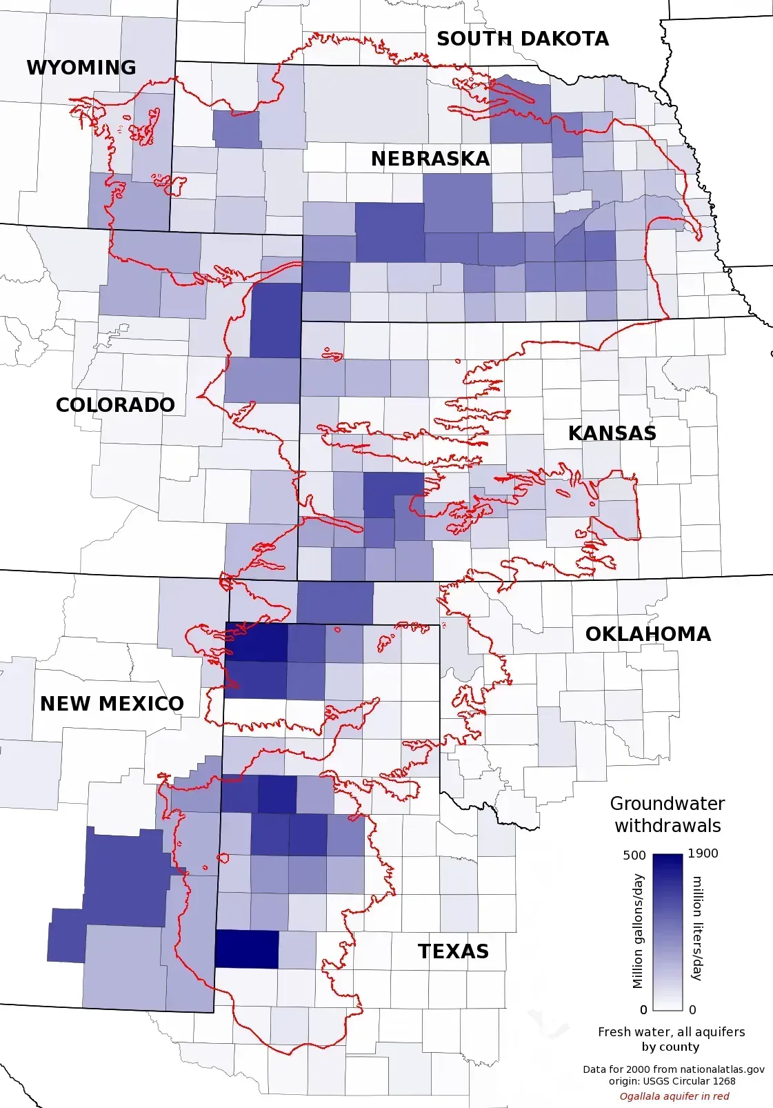
Oklahoma modified its water rules in 2023, only issuing irrigation permits tied to sustainable yield estimates. Kansas and Colorado in 2024 gave authority to local water management districts to limits withdrawals during drought years. Meanwhile, Texas operates under a fundamentally different system. A Texas law granting landowners unrestricted rights to the water beneath their property makes it possible for Pickens to sell groundwater from his 24,000-acre Mesa Vista Ranch in the Texas panhandle to metropolises as far away as Dallas and El Paso. Cooperation across state lines is minimal, hampering unified action. The lack of coordination means each state approaches the crisis differently, and water doesn’t respect state boundaries. What happens in one state inevitably affects neighboring regions. The approach became known as the state’s policy of planned depletion – gradually emptying the aquifer to support farming.
The Ogallala Aquifer stands as both a blessing and a warning. It transformed the American heartland into one of the most productive agricultural regions on Earth, feeding millions and supporting entire economies. Yet we’re burning through this ancient resource at an unsustainable pace, with consequences that will reshape communities, farming, and food production for generations to come. The question isn’t whether the aquifer will run dry in some areas – it’s already happening. The real question is whether we’ll act decisively enough, soon enough, to preserve what remains. What do you think? Can we change course in time?