The Unsolved Atlas: 3 Places on Earth That Modern Satellites Still Can’t Map
We live in an era of extraordinary technological reach. Satellites circle the planet at every altitude, armed with radar, infrared sensors, and high-resolution optical cameras. Yet for all their sophistication, there remain corners of our own world that continue to resist precise, complete mapping. These aren’t far-flung corners of another planet – they are right here on Earth, hiding in plain sight beneath ocean water, ancient ice, and an impenetrable canopy of leaves. The gap between what we assume satellites can see and what they actually capture is wider than most people realize.
1. The Amazon’s Hidden Interior: Where Cloud Cover and Canopy Defeat the Camera
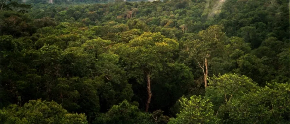
The Amazon rainforest covers an area of around six million square kilometres, making it the largest tropical rainforest on the planet. Satellites have proven effective at tracking deforestation along its fringes, but the deep interior tells a different story. The practical limitations of working in the rainforest mean that data sampling is biased away from the center of the Amazon basin. Persistent cloud cover – a near-permanent fixture over vast stretches of the basin – blocks optical sensors for weeks or even months at a time, leaving critical gaps in surface-level data.
Even when satellites do manage a clear line of sight, the tree canopy itself becomes an obstacle. The Brazilian Amazon Satellite Monitoring Program (PRODES Amazonia) has been tracking losses in the Amazon rainforest for nearly forty years, but in the process they’ve left out a big chunk of land – nearly 280,000 km², or roughly the size of Ecuador. This land, classified as “non-forest vegetation,” is made up of open ecosystems like savannas, grasslands, seasonally flooded areas, and ecotones. While the contrast between forested and deforested regions is pronounced in satellite imagery, non-forest ecosystems are much more heterogeneous, and so their losses can be harder to track. Grasslands, for example, can be confused with cultivated pastures. As lead author Cassiano Messias noted in the 2024 study published in Communications Earth & Environment, “these ecosystems are among the least protected in the Amazon biome,” and their continued loss “represents a significant loss for both scientific knowledge and the biodiversity of the biome.”
2. The Deep Ocean Floor: A World Satellites Simply Cannot See Through
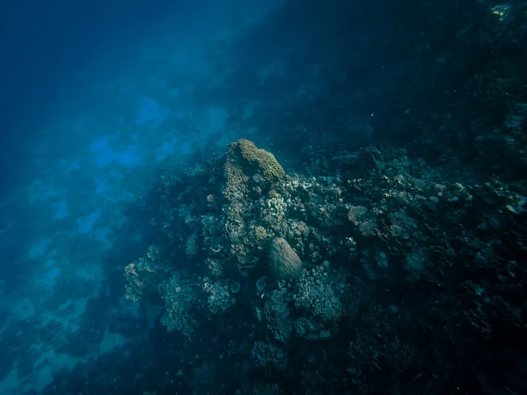
The ocean covers more than two-thirds of our planet, yet it remains the single largest unmapped territory on Earth. The reason is fundamental physics. A satellite cannot detect the bottom of the ocean at all. Instead, it relies on the gravity of undersea ridges and mountains to pile up water into subtle surface swells, which instruments then detect from orbit. Satellite data can’t reveal features smaller than about 12 kilometres across, leaving countless geological structures invisible to space-based observation. Topographic maps of the Moon, Mars, and Venus have 50 times better resolution at 100 metres, and the most remote land on Earth has been mapped at 100 times higher resolution.
Ships outfitted with sonar instruments can make direct, incredibly detailed measurements of the ocean floor – but to date, only about 25% of it has been surveyed in this way. A peer-reviewed study published in the journal Science in December 2024, led by researchers at Scripps Institution of Oceanography, used data from NASA’s SWOT satellite to produce one of the most detailed seafloor maps yet attempted. David Sandwell, a geophysicist at Scripps, called SWOT “a huge jump in our ability to map the seafloor.” Still, even this leap forward has hard limits. Total global mapping coverage in 2024 was 28.5%, according to a 2025 Frontiers in Marine Science study analyzing GEBCO data, and the biggest gaps remain in the central Pacific abyssal plains, parts of the Indian Ocean, remote areas of the Southern Ocean, deep ocean basins far from shipping routes, and some parts of the South Atlantic. Scientists themselves concede: “We won’t get the full ship-based mapping done by then,” said Sandwell, referring to the Seabed 2030 deadline, “but SWOT will help us fill it in.”
3. Greenland’s Subglacial Terrain: Mountains and Valleys Buried Under Miles of Ice
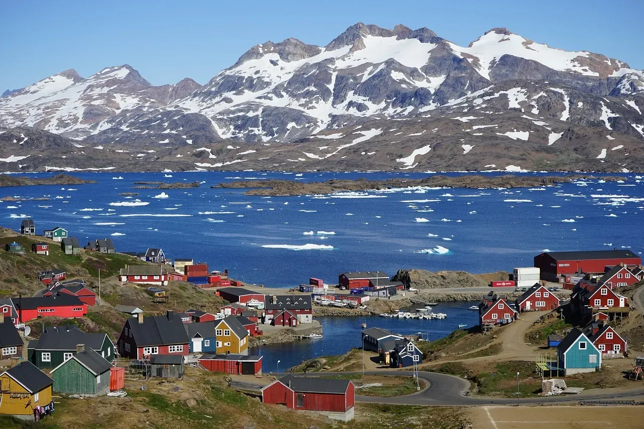
Greenland looks straightforward from orbit – a vast white expanse. The truth beneath that surface is something else entirely. The Greenland Ice Sheet covers nearly 80% of Greenland’s landmass and obscures much of the island’s subglacial geology. As a result, scientists have largely interpolated the island’s geology from rocks exposed at the ice sheet’s margins. Satellites can observe the ice surface with growing precision, but the bedrock and valley systems buried kilometres below remain largely out of reach. The Greenland Ice Sheet is a key contributor to contemporary global sea level rise, and the terrain covered by the ice sheet comprises roughly 79% of Greenland and about 1.1% of Earth’s land surface.
A 2024 peer-reviewed study published in The Cryosphere by Paxman et al. used a combination of airborne radar and satellite imagery to begin mapping what lies beneath. The study used airborne radar data and satellite imagery to map mountainous topography hidden beneath the Greenland Ice Sheet. Their mapping revealed intricate subglacial valley networks with morphologies indicative of substantial glacial modification of an inherited fluvial landscape, yet many of these valleys are presently situated beneath cold-based, slow-moving, non-erosive ice. Three distinct subglacial regions could not be reconciled with the geology at the island’s margins, meaning satellites and even airborne instruments together still fail to deliver a complete picture of what Greenland actually looks like beneath its frozen shell. The authors of the updated geological map acknowledge that it remains an incomplete representation of Greenland’s subglacial geology – and that nothing beats eyes and boots on the ground to examine the rocks present.