The Lost Colony: New Evidence Suggests a Different Ending for the Roanoke Mystery
Few mysteries in American history have gripped the public imagination quite like the disappearance of the Roanoke Colony. In 1587, an expedition of 118 men, women, and children set out from England for the New World, headed by artist and governor John White, reaching Roanoke Island off the coast of present-day North Carolina on July 22. White sailed back to England to gather more supplies and didn’t return until three years later, finding traces of the colony but no inhabitants – just two clues left at the site: the word “CRO” carved into a tree and the word “CROATOAN” carved into a palisade. For more than four centuries those two words were the sum total of what history had to offer. That is changing fast.
The Setup: What We Know About the 1587 Colony
Though the returns from the first two reconnaissance missions were mixed, it was enough to incentivize and outfit a civilian expedition to permanently colonize the new territory with a start-up group of 118 men, women, and children. The objective was to find a deep harbor in the Chesapeake Bay area to establish a port town and to stop briefly at Roanoke Island to retrieve soldiers left by the 1585 expedition, but circumstances altered the original plans and the colonists ended up remaining on Roanoke. Veteran explorer John White was commissioned as the expedition’s leader and colony governor, and along with him came his daughter Ellinor and son-in-law Ananias Dare.
As the months wore on, the colonists faced mounting dangers from dwindling resources, tense relations with the Indigenous Algonquin, and impending winter. A study measuring growth rings from a network of bald cypress trees, producing data ranging from 1185 to 1984, concluded that an extreme drought occurred in Tidewater between 1587 and 1589, with 1587 measured as the worst growing season in the entire 800-year period. As historians point out, “the lost colonists couldn’t survive on their own” – Roanoke Island didn’t have much farming, and the Indigenous tribes grew corn on the mainland, meaning the settlers would have needed to either be fed by or move in with a native town, with the Croatoans being the most likely option.
The Hidden Map: A Secret Fort Changes Everything
In November 2011, researchers at the First Colony Foundation noticed two corrective patches on White’s 1585 map known as La Virginea Pars, and at their request, the British Museum examined the original map with a light table, discovering that one of the patches, at the confluence of the Roanoke and Chowan rivers, covered a symbol representing a fort – with a faint outline of a fort drawn in what might be invisible ink also found on the patch itself. This location, now known as “Site X,” became a focal point for renewed excavation.
White had reason to believe his colony had gone “50 miles into the Maine,” a reference to instructions for the colonists to head 50 miles inland if there was trouble – and the Bertie County site is roughly 50 miles inland from Roanoke Island. There are now two similar sites, Site X and Site Y, on or near Salmon Creek in Bertie County – both located where the 1587 colonists told John White they were heading, both located on the Smith/Zuniga map where Jamestown authorities had been told by neighboring natives that Roanoke colonists could be found, and both located under the patch on the Virginea Pars map at the British Museum that bears two drawn fort or town symbols.
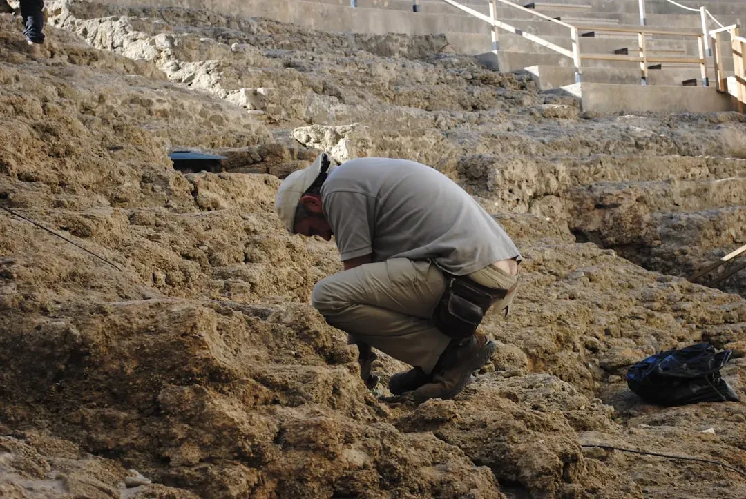
Digging at Bertie County: Sites X and Y Yield Real Answers
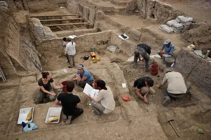
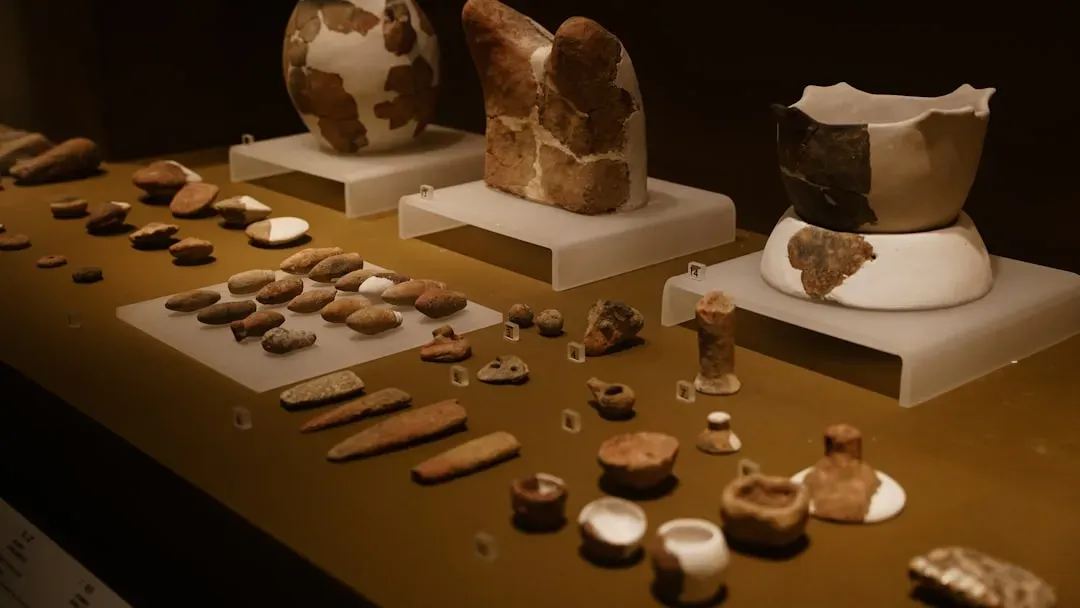
The archaeological findings at Site X took on new significance when viewed alongside historical records – the English pottery discovered was of a specific type manufactured only from the mid-16th until the late 17th centuries, known as Surry-Hampshire Border ware, and found at only two other sites in North America: Roanoke Island and Jamestown. Archaeologists also uncovered other telling artifacts: a three-inch aglet (a cover for a 16th-century shoelace), a distinctive type of flintlock called a Snaphaunce Firing Pan, and pieces of North Devon plain baluster jars used for preserving food during sea voyages. Although the experts haven’t ruled out the possibility that the artifacts may have been left behind by colonists from Jamestown, founded in 1607, the lead archaeologist is confident in the find – notable is a lack of English pipes, which were ubiquitous among Jamestown settlers, suggesting the ceramics date from an earlier period.
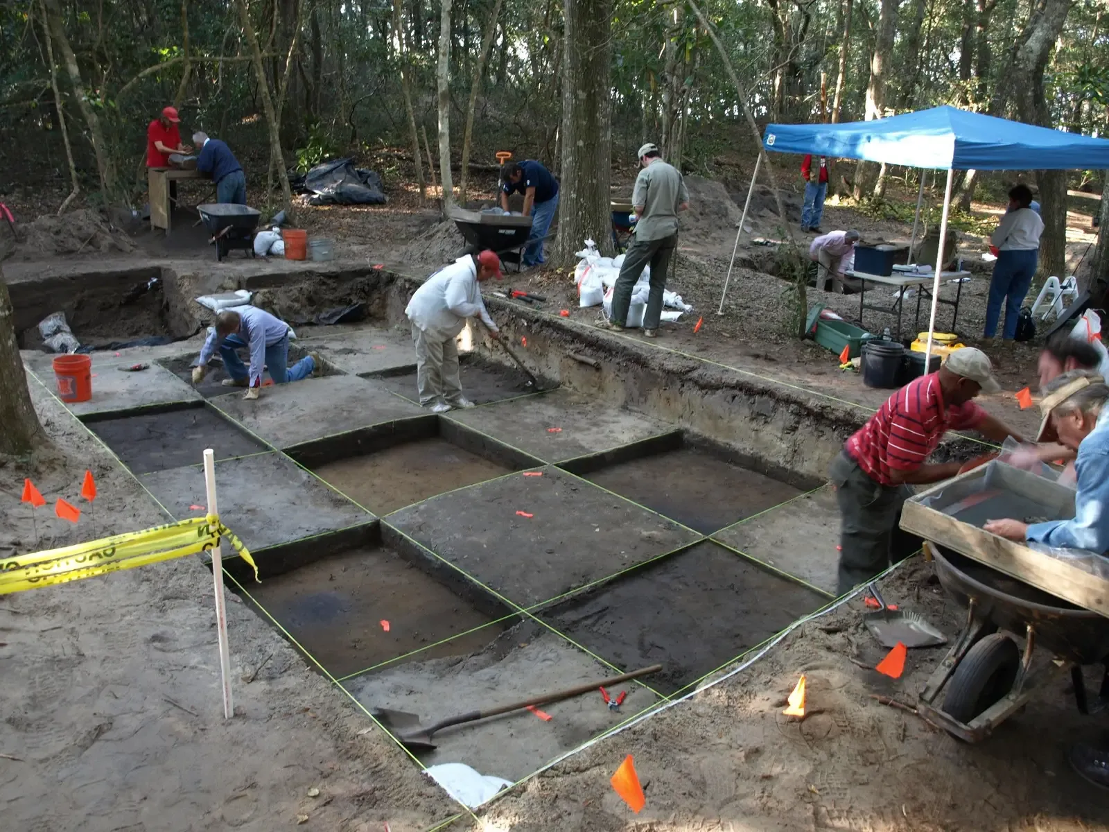
After a hiatus in 2020, the First Colony Foundation resumed excavations in 2024 at Fort Raleigh/Elizabethan Gardens and revisited Site Y in Bertie County, reporting additional 16th-century English ceramics that bolster an inland-relocation scenario. The discovery in Bertie County is considered the first solid evidence that an estimated 115 people not only survived but also found a home in the wilds of the region now known as the Albemarle, though the lead archaeologist notes the colonists are “still lost” and more work is needed to confirm it. The First Colony Foundation stated: “We are very confident that these excavations are linked to the Roanoke colonies. We have considered all other reasonable possibilities and can find nothing else that fits the evidence.”
Hammer Scale on Hatteras: The Croatoan Theory Gains Ground
A discovery in May 2025 added a new layer to the mystery when archaeologists unearthed two piles of iron flakes on Hatteras Island, North Carolina – formerly known as Croatoan Island. Archaeologists found what were described as “buckets” of hammer scale, a leftover material from blacksmithing, with the lead researcher stating: “This is showing a presence of the English working metal and living in the Indian Village for decades – we’re finding this whole metalworking workshop on the site and natives didn’t do that.” Mark Horton, an archaeology professor at the Royal Agricultural University in the UK, noted: “We’ve been digging there for 10 years off and on, and I think the real breakthrough was the hammer scale mixed in with 16th-century artifacts.”
The layer of dirt containing the iron flakes was analyzed with radiocarbon dating, which suggests that its age lines up with that of the Lost Colony. Kathleen DuVal, a history professor at the University of North Carolina at Chapel Hill, stated that the new discovery fits in well with historical and archaeological information, saying: “It absolutely makes sense that the Lost Colony would have moved to Hatteras Island – they wrote exactly where they were going: to Croatoan.” Researchers have found thousands of artifacts showing a mix of English and native life roughly four to six feet deep in the soil, with parts of swords, rings, writing slates, gun parts, and glass in the same layer as Indigenous pottery and arrowheads.
The Elizabethan Gardens Dig: Copper, Pottery, and Contact Confirmed
The search for what happened to the English settlers has recently focused on the Elizabethan Gardens in the town of Manteo, where archaeologists have uncovered evidence of a farmstead belonging to the Algonquian village of Roanoke, an Indigenous community that hosted the settlers in 1584. Excavations in March 2024 uncovered shards of Algonquian pottery dating back to the 1500s, along with a ring of copper wire made of drawn copper, likely worn by an Algonquian warrior, with archaeologists speculating the ring was brought to North America by English settlers and traded with the Indigenous people who believed copper had spiritual significance. Indigenous peoples did not have the technology to produce such rounded strands, and neither the French nor Spanish explorers ventured as far north as Roanoke Island to trade.
Dr. Eric Klingelhofer of the First Colony Foundation stated: “Finding domestic pottery – the type used for cooking – in close proximity to an apparent piece of Native American jewelry strongly confirms we are digging in the midst of a settlement.” Researchers are also beginning to understand the site as “more of a capital with a tribal seat where a ruler or chief lived, and it would be palisaded to keep him safe” – with the chief having presided over a territory comprising present-day Dare County, Roanoke Island, and parts of the mainland at the time of English exploration. Another exploration was scheduled for the summer of 2024 at nearby Fort Raleigh National Historic Site, with the goal of finding evidence of the colonists’ original settlement.
A Colony That Split: The Emerging Consensus and Its Critics
Competing evidence from Hatteras Island supports the theory that some settlers relocated to live among Indigenous Croatoan communities, leaving scholars to conclude the colonists may have split into multiple groups. These advancements have not solved the mystery, but they have reoriented it – rather than focusing solely on Roanoke Island, the search has widened to include the broader Carolina interior, reinforcing the theory that the colonists split up, with some moving inland and others heading south to Croatoan. Documents from the English colony of Jamestown show the Roanoke colony did leave their camp to live with their native friends, and more than a century later, English explorer John Lawson found natives with blue eyes who recounted they had ancestors who could “speak out of a book.”
Not all researchers are convinced, with at least one history and anthropology professor calling the assimilation assumption “a bit of a stretch,” noting she would have expected to see additional byproducts from a blacksmithing forge like charcoal and slag. Charles Ewen of East Carolina University believes the mystery might someday be solved, particularly “if we could find European burials that we could tie to the 16th century with European materials and not trade items.” In April 2025, archaeologists uncovered large amounts of hammerscale, a flaky or spheroidal byproduct of the iron forging process, dated to the time period of the lost colonists – one more piece in a puzzle that remains, for now, incomplete but no longer entirely silent.