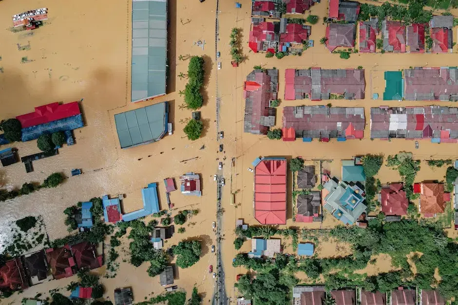
By 2050, NASA Data Suggests These Coastal Cities Could Be at Risk – Not Just Miami
When most people think about cities drowning under rising seas, Miami comes to mind first. And sure, Miami is in trouble. But here’s the thing – the science tells a far wider and more alarming story than that single city on a postcard. From the Gulf of Mexico to Southeast Asia, from the mid-Atlantic seaboard to the Pacific Islands, the ocean is not playing favorites.
The data from NASA, NOAA, and peer-reviewed research published in journals like Nature paints a picture that demands attention. The clock is not ticking in some distant, abstract future. It’s ticking now. Let’s dive in.
The Numbers That Should Alarm Everyone
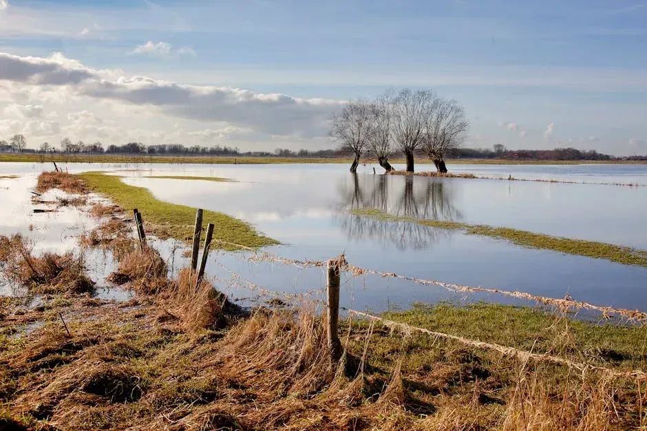
Global sea level rose faster than expected in 2024, mostly because of ocean water expanding as it warms – thermal expansion. According to a NASA-led analysis, the rate of rise in 2024 was 0.23 inches per year, compared to the expected rate of just 0.17 inches per year. That might not sound like much, but when you’re talking about entire coastlines, even fractions of an inch compound into something enormous over time.
Since the satellite record of ocean height began in 1993, the rate of annual sea level rise has more than doubled. In total, global sea level has gone up by 4 inches since 1993. Now think about what another few decades of acceleration looks like.
A federal interagency report – including NASA and NOAA – concluded that sea level along U.S. coastlines will rise between 10 to 12 inches on average above today’s levels by 2050. That means the United States is expected to experience as much sea level rise by 2050 as it witnessed in the entire previous hundred years. That’s not gradual. That’s a compression of a century’s worth of change into barely two decades.
New Orleans, Louisiana – Already Below Sea Level
New Orleans might be the most striking example of a city already living on borrowed time. It’s not just at risk of sinking – parts of it have already sunk. Substantial areas of 318 to 426 square kilometers, a population of 386,000 to 448,000 people, and 176,000 to 209,000 properties in New Orleans are already exposed to high-tide events at present, owing to the existence of areas lying below sea level.
Sea levels in Louisiana could rise by about one foot by 2050 and up to two feet by the end of the century. Under a more extreme scenario, sea level rise could see nearly the entirety of New Orleans’ population displaced – by far the state’s most affected area.
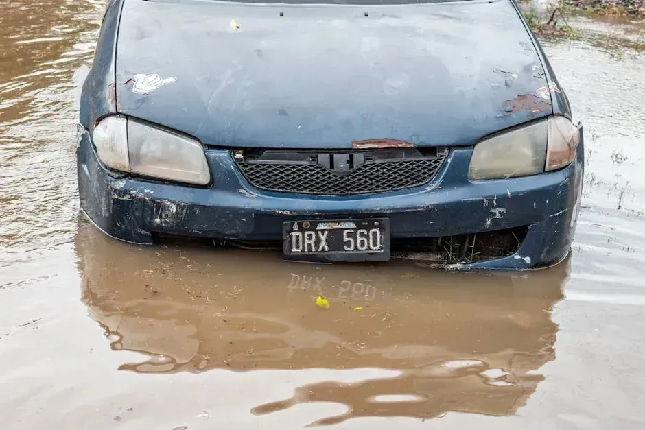
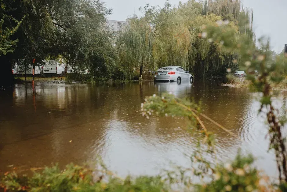
As seen in recent years in New Orleans and along the Gulf Coast, storm surges are amplified by sea-level rise, causing them to hit higher water levels and allowing the surges to reach farther inland. The levee systems offer some protection, but honestly, they were not built for what’s coming.
Norfolk, Virginia – The Fastest-Sinking City on the East Coast
Norfolk rarely makes international headlines, but among climate scientists, it’s something of a case study in dual disaster. The land is sinking – a process called subsidence – while the ocean is simultaneously rising around it. Some of the many impacted communities include New York, Baltimore, Norfolk, Virginia, and Charleston, South Carolina. Subsidence has been described as a pernicious, highly localized, and often overlooked problem in comparison to global sea level rise, but it is a major factor explaining why water levels are rising in many parts of the eastern U.S.
Many cities on the Eastern Seaboard – including those that are not sinking – are at higher risk of coastal flooding in part because of their lack of physical protection. Much of the Gulf Coast is sinking rapidly, though the number of people exposed to flooding risk is not as high as the more populous East Coast.
By 2050 relative to sea level in 2000, relative sea level rise projections range from 0.40 to 0.45 meters along the East Coast and 0.55 to 0.65 meters along the Gulf Coast. For Norfolk, sitting squarely in the mid-Atlantic zone, those numbers translate into regular, disruptive flooding of neighborhoods, military installations, and critical infrastructure.
Charleston, South Carolina – High-Tide Flooding Is Already Routine
Charleston is one of America’s most storied and beautiful cities. It is also one of its most geographically vulnerable. Along the coastal Southeast, Charleston, South Carolina, observed 17 flood days in 2023. Seventeen days in a single year. That is not a once-in-a-decade event – that’s a recurring pattern of disruption.
Flooding that used to occur just once or twice a year could increase in frequency to about two to three months a year by 2050 in the Lowcountry region around Charleston. Think about what that means for property owners, local businesses, and the city’s historic downtown district built right along the waterfront.
The estimated flood exposure is underestimated in cities where vertical land motion is not properly accounted for – including Atlantic City, Charleston, Savannah, Mobile, and Biloxi. In other words, the real risk to Charleston may actually be worse than most official models suggest.
New York City – $129 Billion in the Floodplain
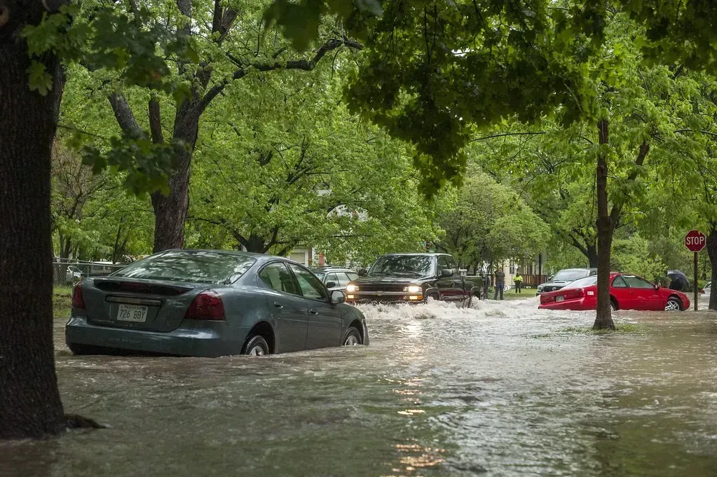
New York City needs no introduction when it comes to extreme weather. Hurricane Sandy in 2012 already showed the world what a large storm surge can do to one of the most densely built urban environments on Earth. Some of the most valuable properties in the world are located in flood-prone areas at the southern tip of Manhattan, with real estate valued at an estimated $129 billion lying within the city’s floodplains. When Hurricane Sandy struck in 2012, coastal floods impacted an estimated 90,000 buildings in New York City alone, while 2 million people lost power and the city suffered over $19 billion in damage.
Around 2.5 million Americans in 1.4 million homes live in areas at risk from a severe coastal flood in 2050. Florida, New York, and New Jersey have the most people and homes in areas at risk from a severe coastal flood. New York is not the exception. It is right at the center of the problem.
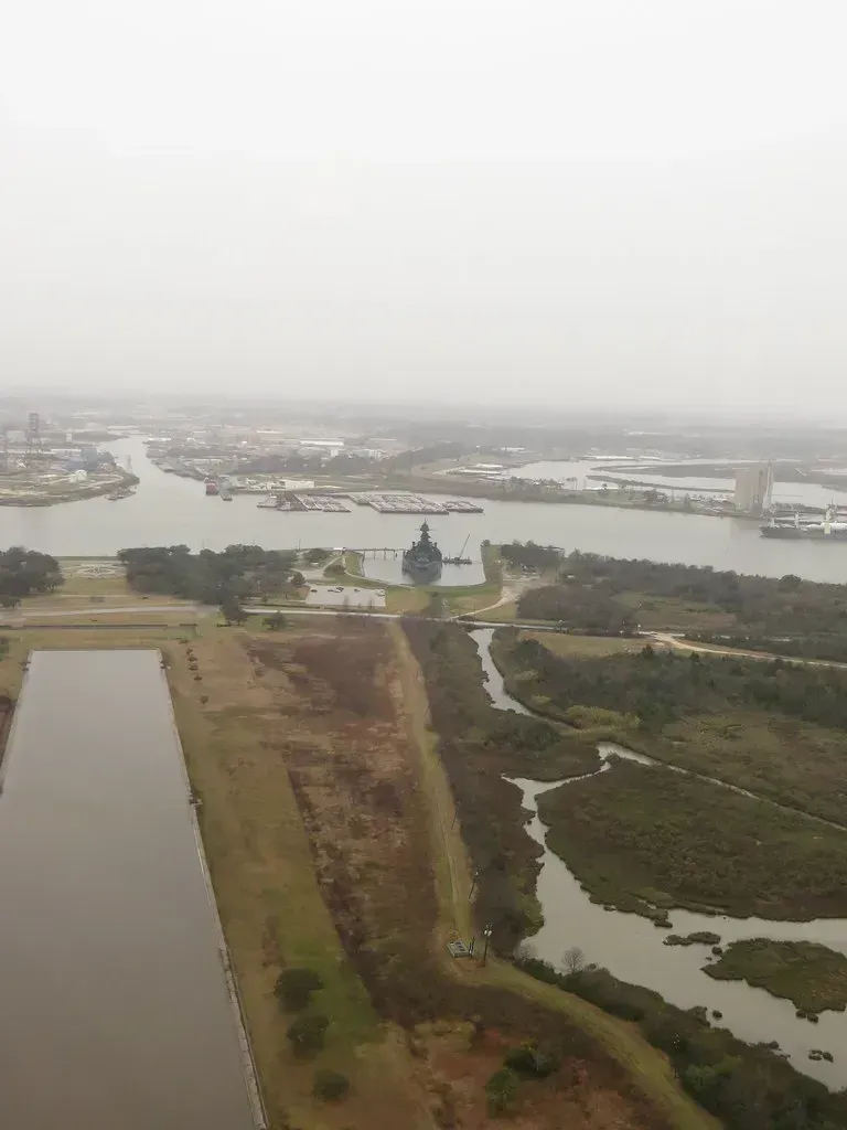
Houston and Galveston, Texas – Sinking Ground, Rising Water
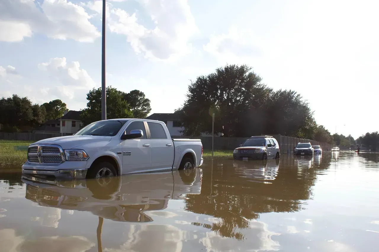
Texas has a land subsidence problem that makes its sea level risk uniquely dangerous. On the Gulf Coast, southern Louisiana is a hot spot for sinking land, as is southeast Texas, including areas around Galveston, Freeport, and Corpus Christi. Groundwater extraction is one of the primary drivers of coastal subsidence. Cities and industries are pumping water from underground aquifers faster than it can be replenished, a situation exacerbated by climate change-driven drought.
Some of the world’s largest ports, such as Houston, are at risk of becoming inoperable by 2050 due to rising sea levels. That statement alone should spark a serious conversation. Houston is a global hub for the energy industry and one of the busiest port complexes on the planet.
As much as a third of sea level rise in this region over the next three decades could come from the sinking effect alone. The land is essentially meeting the sea halfway. It is a slow-motion collision, and the timeline is tightening.
Tampa, St. Petersburg, and Cape Coral – Florida Beyond Miami
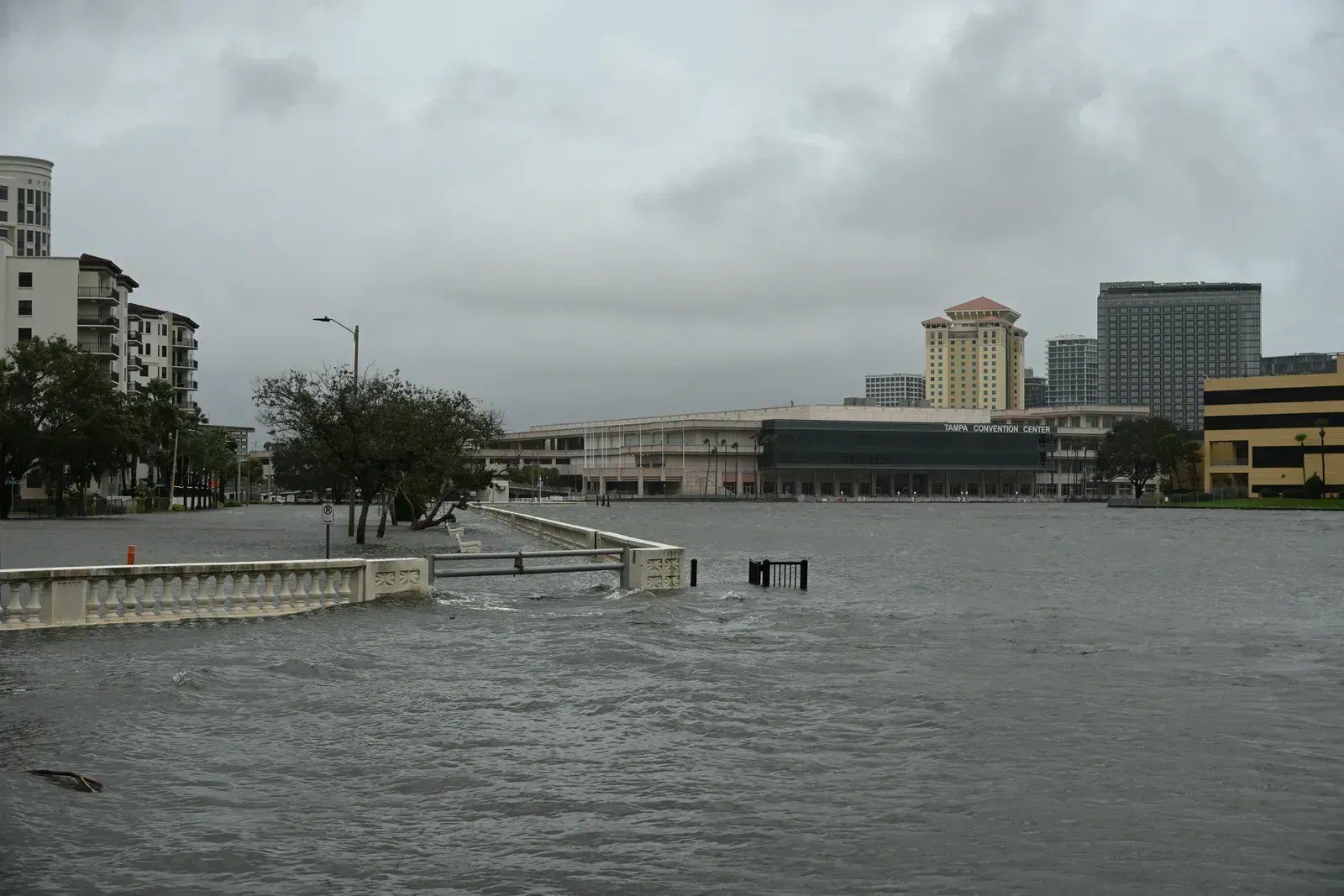
Miami gets all the press, but Florida’s west coast deserves equal concern. Rising water levels are projected to affect multiple cities in Texas and Florida, including Tampa, St. Petersburg, and Cape Coral on the Gulf side. These cities are low-lying, densely populated, and in the direct path of Gulf Coast storm surges that are only growing more intense.
Low-lying cities like Miami are already experiencing frequent sunny-day flooding, when high tides spill onto streets or bubble up from storm drains. Events like these will only become more common and more damaging as sea level rise continues. The same phenomenon is increasingly showing up along Florida’s Gulf Coast cities, catching residents off guard even on perfectly cloudless days.
According to research from Climate Central and Zillow, a worst-case scenario of unchecked emissions could expose 3.4 million existing homes to high risk of flooding by 2100, and those homes are currently worth $1.75 trillion – roughly nine percent of the entire U.S. economy. Florida sits at the epicenter of that financial exposure.
Bangkok and Jakarta – The Global Picture Is Staggering

Zoom out from the U.S. coastline, and the scale of this problem becomes almost incomprehensible. According to C40 Cities analysis, the total urban population at risk from sea level rise, if emissions don’t decrease, could number over 800 million people, living in 570 cities, by 2050. That’s not a rounding error. That is a civilization-scale challenge.
Sea level rise projections put Bangkok as the world’s most vulnerable city. The low-lying Thai capital has an average elevation of just 1.5 meters above sea level and is already paying the price for this phenomenon. Combined with the predicted increase in extreme weather events, roughly one-third of the Thai capital could be completely submerged by 2050, displacing up to 11 million people.
Jakarta, Indonesia, faces a nearly identical fate. In Jakarta, climate change, combined with urban development patterns and the geographic condition of being a low-lying delta city, reinforce each other in a troublesome spiral. The result is inundated homes and paralyzed metropolitan infrastructure, along with increased health hazards from polluted floodwaters. Indonesia has already begun relocating its capital city, in part because of this existential threat.
The Hidden Danger – Sinking Land Accelerates Everything
Here’s something most people don’t hear about enough. Sea level rise isn’t only caused by the ocean getting higher. In many cities, the land itself is sinking – and that doubles the danger. One in 50 people living in two dozen coastal U.S. cities could experience significant flooding by 2050, according to Virginia Tech-led research published in Nature. The study combines satellite measurements of sinking land with sea-level rise projections and tide charts across 32 cities along the Atlantic, Pacific, and Gulf coasts.
The study predicts as many as 500,000 people will be affected by flooding alongside roughly one in 35 privately owned properties within the next three decades, and it highlights the racial and socioeconomic demographics of those potentially affected.
Researchers found that people of color and low-income populations on the Gulf Coast are disproportionately affected by the risk. People identifying as Black or African American account for more than half of those who will be exposed by 2050, despite representing only about 29 percent of the region’s total population. This is not just a climate story. It is an equity story too.
Toxic Sites, Infrastructure, and the Economy at Stake
The financial and public health stakes extend well beyond flooded streets and damaged homes. More than 5,500 toxic and hazardous sites across the United States are projected to be at risk of coastal flooding as sea levels rise by 2100, with nearly 3,800 facing similar danger as early as 2050 under high-emissions scenarios, according to a peer-reviewed study led by University of California scientists.
Seven states – Florida, New Jersey, California, Louisiana, New York, Massachusetts, and Texas – account for nearly 80 percent of the hazardous sites at risk by 2100. These are not remote wetlands. Many of these facilities sit in or near populated urban areas.
Major energy, communication, and transportation centers are located on coastlines, putting their operations and physical safety at risk as sea levels rise. Many of the approximately 104 nuclear power plants in the U.S. are situated along the coast because nuclear plants require water for cooling. These facilities and their supporting infrastructure are at risk of damage with rising sea levels. The layers of risk go deep – literally and figuratively.