The “Zillow Cliff”: Why Home Prices in These 5 Flood Zones Are Quietly Falling
Something is shifting in the American housing market, and it’s moving quietly beneath the headlines. In flood-prone ZIP codes from Florida to New Jersey, home prices are softening in ways that traditional market reports don’t fully capture. Buyers are increasingly armed with climate risk data, insurance costs are squeezing monthly budgets, and the psychological weight of a flood score on a listing page has proven to be very, very real. The phenomenon has been informal called the “Zillow Cliff” – the moment a prospective buyer sees a high flood risk score on a listing and simply walks away.
1. The Data Behind the Drop: How Flood Risk Labels Changed Buyer Behavior
In fall 2024, Zillow rolled out a “climate risk threat score” on all U.S. for-sale listings, spanning flood, wildfire, wind, heat, and air quality categories, based on data from First Street Technology. The impact on the market was almost immediate. More than 80% of buyers now consider climate risk when purchasing a home, according to a survey by Zillow, with respondents ranking flood risk as their highest concern, followed by fire.
Zillow’s analysis of its own data found that homes listed in June 2024 with a high flood risk were less likely to sell by March 2025 than those with a low flood risk – just 52% of the high-risk homes sold compared to 71% of the low-risk homes. That gap is enormous by real estate standards. Zillow’s own market research shows that homes with extreme flood risk scores tend to sell more slowly and often at a discount compared to initial list price, with high-risk flood homes in New Jersey selling 3% below list price versus 3% above for low-risk listings.
2. South Florida and Miami: The Flood Discount Is Already Here
A Cotality study found that homes sitting within Miami’s 100-year flood zone saw a reduction in value of between 9% and 18% per square foot – though those discounts are often offset by the increasing cost of insurance. For buyers, that’s a double punch: lower property value and higher carrying costs. The 2025 flood maps incorporate cutting-edge technologies like LiDAR and updated elevation models, with significant changes including expanded high-risk zones in South Florida coastal areas, especially parts of Broward and Miami-Dade counties, and the reclassification of some properties previously deemed moderate or low risk into higher-risk zones.
South Florida is among the most climate-sensitive real estate markets in the country, with flooding, storm surge, and rising insurance costs already shaping how and where homes are bought and sold. The insurance picture compounds the pricing pressure. In high-risk states like Florida and Texas, some insurers have gone bankrupt or exited the market, putting pressure on state-backed insurers, while rising premiums signal strain especially in coastal areas. With fewer private insurance options, homeowners either pay inflated premiums or forgo adequate coverage, which affects who can qualify for a mortgage and shrinks the buyer pool.
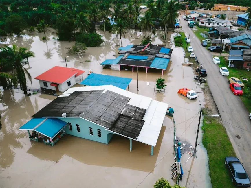
3. St. Petersburg, Tampa Bay, and Florida’s Gulf Coast: Storm Fatigue Sets In
In late 2024, Hurricane Helene made landfall near the Gulf Coast as a strong Category 2 storm, bringing heavy rainfall, moderate storm surge, and localized flooding to parts of St. Petersburg. Just months later, Hurricane Milton followed a similar path, causing additional water damage and power outages in low-lying neighborhoods. The back-to-back hits left buyers and sellers rattled. Home values in high-risk flood zones have dipped by 5–10% in the past 12 months, while properties outside flood zones are in higher demand, often selling faster and closer to asking price, with buyers factoring in flood insurance costs and elevation certificates during negotiations.
Thanks to FEMA’s Risk Rating 2.0 pricing model, flood insurance premiums are now being assessed more accurately based on property-specific risks, resulting in premium increases of 20–70% for some homes in high-risk zones and stricter lender requirements for flood coverage as a condition of the mortgage. Ground-level properties in flood zones faced tougher economics: higher insurance premiums, major structural repairs, and in some cases, special assessments for condo owners. The combination of physical storm damage and pricing correction is creating a lasting reset in how Gulf Coast properties are valued.
4. Virginia Beach and the Carolina Coast: Slower Sales, Shrinking Pools
Charleston, S.C., Wilmington, N.C., and Virginia Beach, Va. are not the typical suspects for hurricane risk. However, these cities are home to over 656,000 homes at risk of flooding if a major hurricane makes direct landfall. That exposure is starting to show up in transaction data. Cotality data shows homes in Virginia Beach, Va. stayed on the market 32% longer in 2025 than in early 2024, while during the same period, Wilmington, N.C. homes lingered 19% longer.
Before Hurricane Sandy in 2012, coastal properties across the northeastern U.S. were a sound investment, rising in value significantly faster than the national median. Since Sandy, northeastern coastal properties have been a less competitive investment, with home value growth lagging the national median by about 25%. The Carolinas and Virginia are now living through a similar market re-calibration. As more housing stock sits on the market in at-risk regions, prices are likely to decline. This can leave homeowners with underwater mortgages or with a property worth far less than they anticipated, undermining the wealth they’ve spent years building.
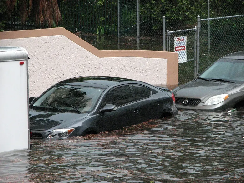
5. Houston, Texas: Decades of Flood Risk Finally Priced In
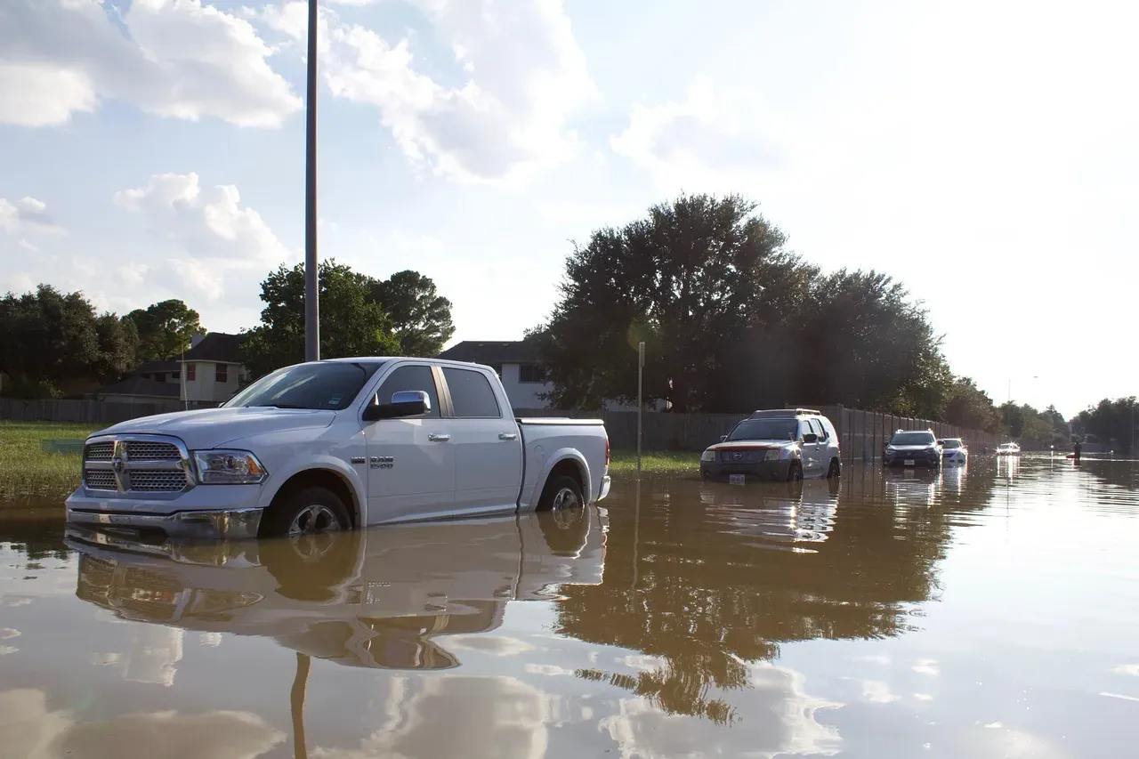
Hurricane Harvey stalled over the Gulf Coast of Texas, depositing as much as 50 inches of rain on the city of Houston in Harris County over several days. Moody’s Analytics estimated the total economic loss from Harvey was $81.5 billion in 2017 dollars, and FEMA paid out almost 50,000 claims in Harris County following the storm. The legacy of that event continues to reshape Houston’s real estate market. Since Hurricane Harvey, one in every five homes built in the Greater Houston area has been constructed in a floodplain, according to a recent investigation from the Houston Chronicle.
For the first time since 2001, Harris County is in the process of redrawing its floodplain maps. It is likely that the new 100-year floodplain boundary will expand to include the former 500-year floodplain, meaning roughly 25% of county homeowners will find themselves in the growing and more vulnerable 100-year floodplain instead, which could equal a five-fold increase in flood risk. Official hazard maps have been criticized in recent years for either being out of date or underestimating a property’s level of risk. Nearly twice as many properties carry a 1% annual risk of flooding than are listed on FEMA’s flood maps, which are used to designate which properties are required to carry flood insurance, according to a Louisiana State University analysis. As those maps are redrawn and insurance requirements follow, Houston’s flood-zone homeowners are absorbing a repricing that the market deferred for years.
The cost of insurance is already factored into home prices, and as both the cost and necessity of insurance rise, home values in the most affected areas will fall. Across all five of these regions, the story is the same: flood risk, once abstract, is now written into the numbers on a listing page. As First Street spokesperson Matthew Eby put it, “when buyers lack access to clear climate-risk information, they make the biggest financial decision of their lives while flying blind. The risk doesn’t go away; it just moves from a pre-purchase decision into a post-purchase liability.”